Cities are full of complex structures that are constantly evolving. These structures include many objects such as roads, buildings, trees, traffic signs, garbage bins, bicycle stops, etc. Creating an inventory of these objects and tracking related objects is vital in many fields such as urban planning, traffic management, security and environmental analysis. Creating this inventory using traditional methods is time consuming and costly. However, new technologies developed in recent years greatly facilitate this process. One of these technologies is our product Objexa, which performs object recognition from artificial intelligence-based panoramic images and LiDAR point data.
What is Panoramic Imagery and LiDAR Point Cloud?
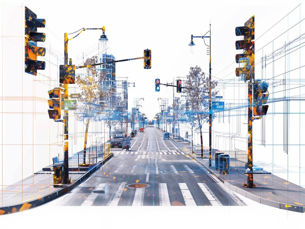
A panoramic image is a picture taken by a wide-angle camera that covers a 360-degree field of view. These images can comprehensively capture environmental information and create a detailed image. LiDAR (Light Reflection and Distance Detection) is a technology that determines the location and distance of surrounding objects using laser beams. LiDAR creates 3D point cloud data and produces a precise map of environmental structures.
Combined Technologies to Recognize City Objects and Create Inventory
Panoramic imagery and LiDAR point cloud data form a powerful combination for recognizing city objects and creating inventory. When integrated with artificial intelligence and machine learning algorithms, this technology can automatically recognize and classify different objects in the city. For example, a camera can recognize traffic signs, while LiDAR can detect buildings and trees. When this data is combined, a complete inventory of traffic signs, buildings, trees and other city objects can be created.
So, what are the benefits of Inventory Creation Technology with Object Recognition?
Fast and Automatic: It is much faster and automatic than the city inventory creation process done by manual methods.
Precision:Panoramic imagery and LiDAR point cloud data operate with very high precision, resulting in a detailed map of environmental structures.
Cost Effective:Automated inventory creation and object recognition process minimizes manpower and time cost.
As a result
Panoramic image and LiDAR point cloud-based object recognition systems are creating a revolutionary impact in many fields such as urban planning, traffic management, security and environmental analysis. With the development of these technologies, we can help cities become smarter and more sustainable.